| Contenidos de Wikipedia en español bajo licencia CC BY-SA 4.0 ⇔ Mapas de OpenStreetMap bajo licencia ODbL |
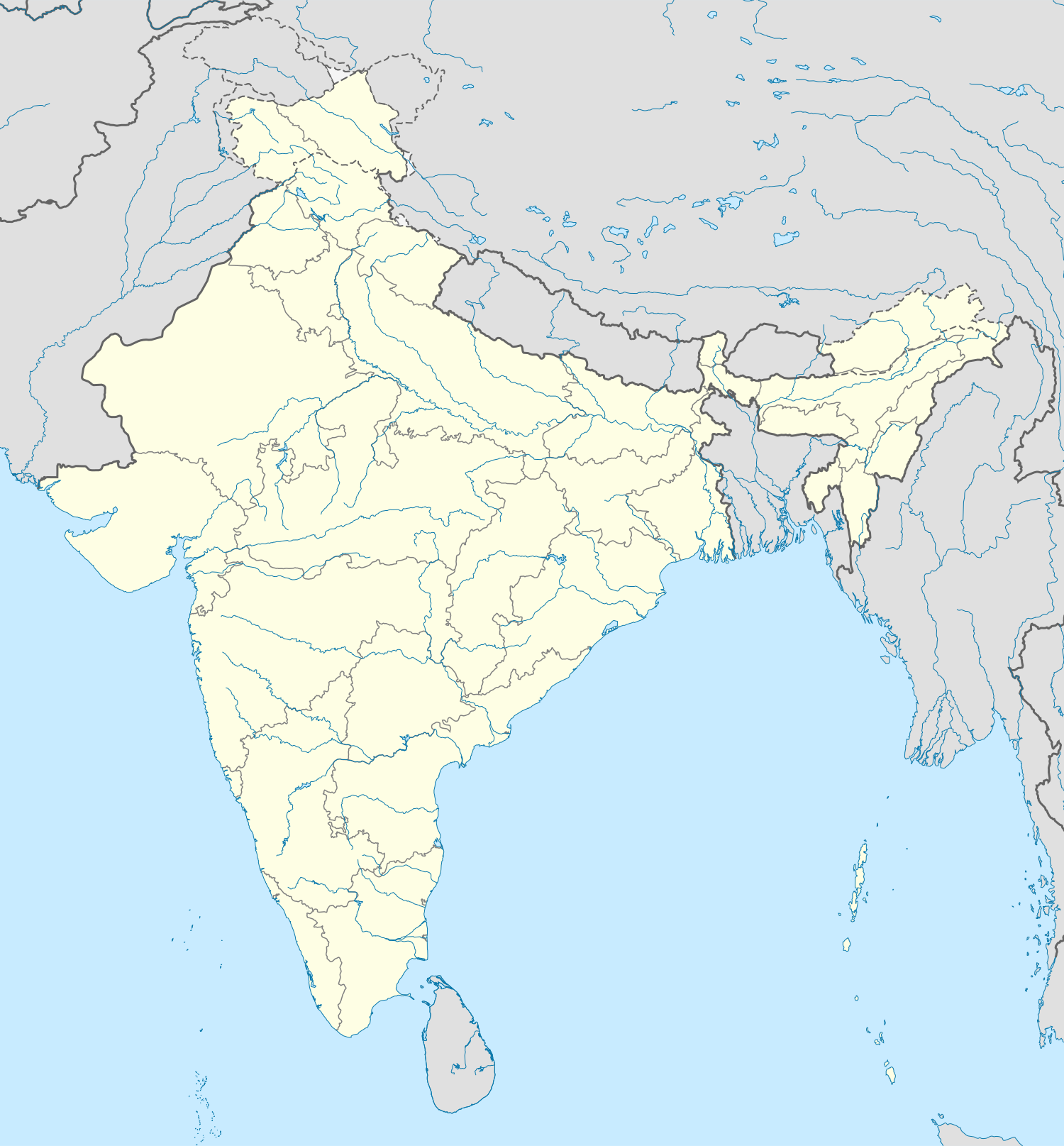
Archivo:India location map.svg
Resumen
| Descripción |
English: Location map of India.
Equirectangular projection. Strechted by 106.0%. Geographic limits of the map:
|
| Fecha | |
| Fuente | Trabajo propio |
| Autor | Uwe Dedering de Wikipedia en alemán |
| Otras versiones |
Obras derivadas de ésta: []
|


Licencia

|
Se autoriza la copia, distribución y modificación de este documento bajo los términos de la licencia de documentación libre GNU, versión 1.2 o cualquier otra que posteriormente publique la Fundación para el Software Libre; sin secciones invariables, textos de portada, ni textos de contraportada. Se incluye una copia de la dicha licencia en la sección titulada Licencia de Documentación Libre GNU. |


- Eres libre:
- de compartir – de copiar, distribuir y transmitir el trabajo
- de remezclar – de adaptar el trabajo
- Bajo las siguientes condiciones:
- atribución – Debes otorgar el crédito correspondiente, proporcionar un enlace a la licencia e indicar si realizaste algún cambio. Puedes hacerlo de cualquier manera razonable pero no de manera que sugiera que el licenciante te respalda a ti o al uso que hagas del trabajo.
- compartir igual – En caso de mezclar, transformar o modificar este trabajo, deberás distribuir el trabajo resultante bajo la misma licencia o una compatible como el original.

Depiction of India's borders
- The territorial boundaries of India are shown as per the actual ground situation in accordance with international practices followed by the United Nations and the National Geographic Society
- This map is meant to be for illustrative purpose only and is not authenticated by official government sources. Please check the list of sources and references used to create the map for a measure of accuracy and verifiability.
- The usage of these maps in India, Pakistan and China are governed by different laws that restrict depictions of boundaries other than what is officially recognized by the state. Please check local laws and modify the map accordingly before use.
Explanation of disputed boundaries


- Boundary of Indian claim : The territory India claims is legally theirs, but the claim is disputed by China and Pakistan.
- Line of Control/Line of Conflict : The de facto administrative boundary recognised by the international community. This UN ceasefire line is considered as a temporary solution to an ongoing conflict since the departure of the British Raj.
Borders of disputed regions
The extent of the former territory of the British Indian Empire, seceeded by Republic of India depicted on this map may not be accepted by most countries as legal due to ongoing border disputes:
- The northern Himalayan region of the disputed territory Indian-administered Kashmir is claimed by India including (Pakistan-administered Kashmir) and the Chinese Occupied territory of (Ladakh plateau). It is currently divided between all three countries since 1972. See also Line of Control and Line of Actual Control.
- Siachen glacier (shown white) is an actively contested region between India and Pakistan. At present the region is in control of India since 1984.
- The northeastern territory of Arunachal Pradesh is almost entirely claimed by China as part of its Tibetan territory.
- Minor areas of eastern Ladakh, Himachal Pradesh and Uttarakhand on the Chinese frontier are claimed by China. These areas are under Indian control.
- A small area of Uttarakhand adjoining the Nepal border along the Sarda river is disputed between the two countries.
For a detailed map of all disputed regions in South Asia, see Image:India disputed areas map.svg
Internal borders
The borders of the state of Meghalaya, Assam and Arunachal Pradesh are shown as interpreted from the North-Eastern Areas (Reorganisation) Act, 1971, but has yet to be verified.
Territorial waters
The limit of the territorial waters of India extends to twelve nautical miles measured from the appropriate baseline. See this archive copy at the Wayback Machine for more information.
Registro original de carga
Transferido desde de.wikipedia a Commons por Uwe Dedering.
- 2010-02-21 16:39 Uwe Dedering 1500×1615× (2412750 bytes) {{Information |Beschreibung = very little borders style changes |Quelle = |Urheber = |Datum = |Genehmigung = |Andere Versionen = |Anmerkungen = }}
- 2010-02-21 14:16 Uwe Dedering 1500×1615× (2411518 bytes) {{Information |Beschreibung = North now 37.5, changed disputed areas |Quelle = |Urheber = |Datum = |Genehmigung = |Andere Versionen = |Anmerkungen = }}
- 2010-02-20 16:44 Uwe Dedering 1500×1540× (2246850 bytes) {{Information |Beschreibung = Location map of India. Equirectangular projection. Strechted by 106.0%. Geographic limits of the map: * N: 36.0° N * S: 5.0° N * W: 67.0° E * E: 99.0° E Made with Natural Earth. Free vector and raster map data @ nat
Historial del archivo
Haz clic sobre una fecha y hora para ver el archivo tal como apareció en ese momento.
| Fecha y hora | Miniatura | Dimensiones | Usuario | Comentario | |
|---|---|---|---|---|---|
| actual | 10:24 4 abr 2021 | Sin miniatura | 1500 × 1615 (1,23 MB) | wikimediacommons>TKsdik8900 | Fulfilling the edit request (File talk:India location map.svg#Upload more compact version of India location map) by C1MM |
Usos del archivo
Las siguientes páginas usan este archivo: